On March 11, we untied from the dock at Club de Pesca Marina in Cartagena and began our two-day run to Santa Marta, Colombia with a rested crew. Luisa and Jules still planned to continue on to the Bahamas with us and Sue joined us once again to assist with the next leg of our journey.
On the first day, we left Cartagena at 4:00 a.m. to begin our 50-mile run to Bahia Valera. We knew that, overall, the trip was going to be a challenge. This time of year, the trade winds consistently blow from east-northeast in this area of the Caribbean. For the run from Cartagena to Bahia Valera, our direction of travel was generally northeast, which allowed for a starboard tack, but with the wind and waves so close to our bow, the day was uncomfortable, to say the least. The 50-mile run took 13 hours.
Day two was a different story. Traveling from Bahia Valera to Santa Marta required a more eastern course that angled directly into the wind and waves. Our initial speed while attempting to motor into the elements was occasionally less than 2 knots. Our only option to increase our speed was to raise reefed sails and motor sail, tacking (zig-zagging) a course to move Traveler through the water faster. But moving faster does not always result in arriving sooner.
There are two common terms that relate to speed when sailing: Speed Over Ground (SOG) and Speed Made Good (SMG).
SOG is simply the speed at which the boat is traveling at any given time. In our case, this is determined by constant GPS tracking.
SMG is the average speed the boat has traveled from start to finish between any two points on a chart. This is determined by dividing the direct distance between two points by the time it took to travel from one to the other, regardless of the route followed.
On day one, we traveled 50 miles over 13 hours. Our SMG was 3.8 knots. On day two, we traveled 55 miles over 20 hours. Even though our SOG at times was 6 knots, our SMG was 2.75 knots!
Such is the way of sailboat travel.
Today is our twelfth day at Marina Santa Marta. We have been monitoring weather closely throughout our stay. Traveling along the Pacific Coast, particularly south of Mexico, we often paused for wind to increase in order to sail. Perhaps this explains how the Pacific Ocean - "Peaceful in character or intent" - got its name. Here, on the Caribbean section of the Atlantic, the situation has changed.
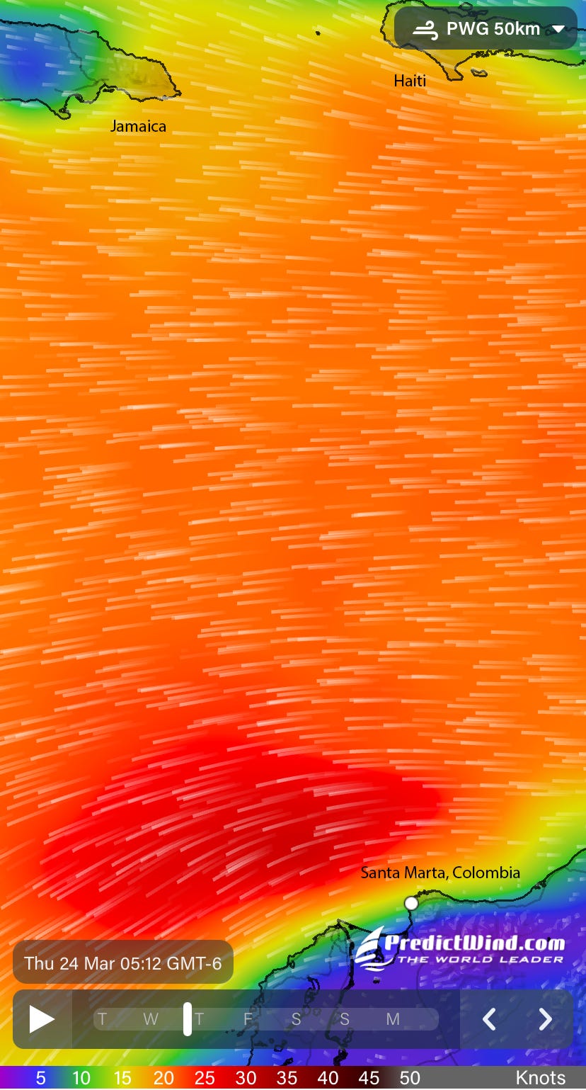
We have now been waiting nearly two weeks for a reasonable 4-day window of manageable wind and waves to make our next run. Three days ago, one of the owners of a boat in the marina clocked a wind speed of 47 knots (54 mph)! And that is in the marina where there are no waves. Offshore, the waves have been consistently 10-12 feet.
We have managed a couple Santa Marta side trips during our wait. We made a two-day trip to Tayrona National Park and another to Minca while keeping one eye on weather apps such as Windy and PredictWind, searching daily for our "go-time" weather window.
Our next run is a 450-mile crossing to Jamaica. Our heading will be primarily north, while the wind, wave and current direction will be from the east. This should offer us a favorable, beam reach, point of sail. A beam reach implies that the wind direction is perpendicular to the heading of the sailboat. Typically, this is the fastest and easiest point of sail, but it will not come without its own unique set of challenges.
When sailing, wind is good, mostly. Wind produces waves. Currents are influenced by wind as well. This presents an opportunity to introduce another pair of sailing terms:
Set: The true direction toward which a current flows.
Drift: The speed of a current.
For this next run, set and drift matter - a lot. Since the wind, waves and current will be on our starboard (right) beam for an entire 450-mile run, Traveler will be continuously "set" downwind. We know that the approximate current "drift" is 1 knot. Without considering the influence of the wind and waves, the current alone will be pushing Traveler to the west for days.
Four hundred fifty miles at 5 knots will require 90 hours of travel. If the current sets Traveler to the west at 1 knot, without a heading correction she will miss her mark by 90 miles. Our intention is to round Jamaica on the eastern-most end of the island. The length of Jamaica, east to west, is 145 miles. The good news is, without correction, we would still land at Jamaica. The bad news is, we would be 90 miles west of our target.
The eastern edge of Jamaica is 344º from our current location in Santa Marta. Ninety miles east of Jamaica is near the western shore of Haiti, which is approximately 360º from our current location. If we aim for the western shore of Haiti, we should hit our mark on the eastern shore of Jamaica.
Ponder that for a moment...and wish us luck!
We have now been living south of the US border for five months. Beginning tomorrow, Latin America will be off our stern for the remainder of our trip. Our experiences and welcoming encounters with locals in Mexico, El Salvador, Costa Rica, Panama and Colombia have been wonderful. It's exciting to finally set our course to north; it's also great to be carrying with us the rich Latin American memories that have been forged along the way.
So long, Colombia. So long, Latin America. Thanks for a great time!


